Where in the world is Combe?

Close scrutiny of the 1901 census shows something rather odd about the inhabitants of Combe.  On first sight it would seem that many of the 90 or so inhabitants identified as having been born in Hampshire but were now living in Berkshire – a sort of mass migration across the border to the north. Had they left behind them a deserted village somewhere like Imber on Salisbury Plain or Tyneham in Dorset? If not, what had happened sometime in the previous ten years?

Close scrutiny of the 1901 census shows something rather odd about the inhabitants of Combe.  On first sight it would seem that many of the 90 or so inhabitants identified as having been born in Hampshire but were now living in Berkshire – a sort of mass migration across the border to the north. Had they left behind them a deserted village somewhere like Imber on Salisbury Plain or Tyneham in Dorset? If not, what had happened sometime in the previous ten years?

What had actually occurred happened a long way from Combe; in the hallowed debating chambers and offices of Westminster the late Victorian governments had been bringing in laws to change how the country was being governed at a local level. Late nineteenth century policy changes are totally mind boggling unless you are one of those people for whom study of such minutiae brings you deep joy. However, put simply the 1894 Local Government Act enabled elections to take place for district and parish councillors. In doing so it brought a level of democracy much nearer for many people. This was mostly men, although the 1894 Act enabled women who owned property to vote in local elections.

Before district and parish councillors could be elected, it was necessary to determine where district and more importantly parish borders actually were. A glance at early nineteenth century county maps will show that back then not all county boundaries were where they are now. One such example is Combe which was originally in Hampshire although for the purposes of the Poor Law it was part of the Hungerford Union. This meant that anyone in Combe unlucky enough to fall upon hard times such that they could not look after themselves might find themselves in the workhouse in Hungerford.

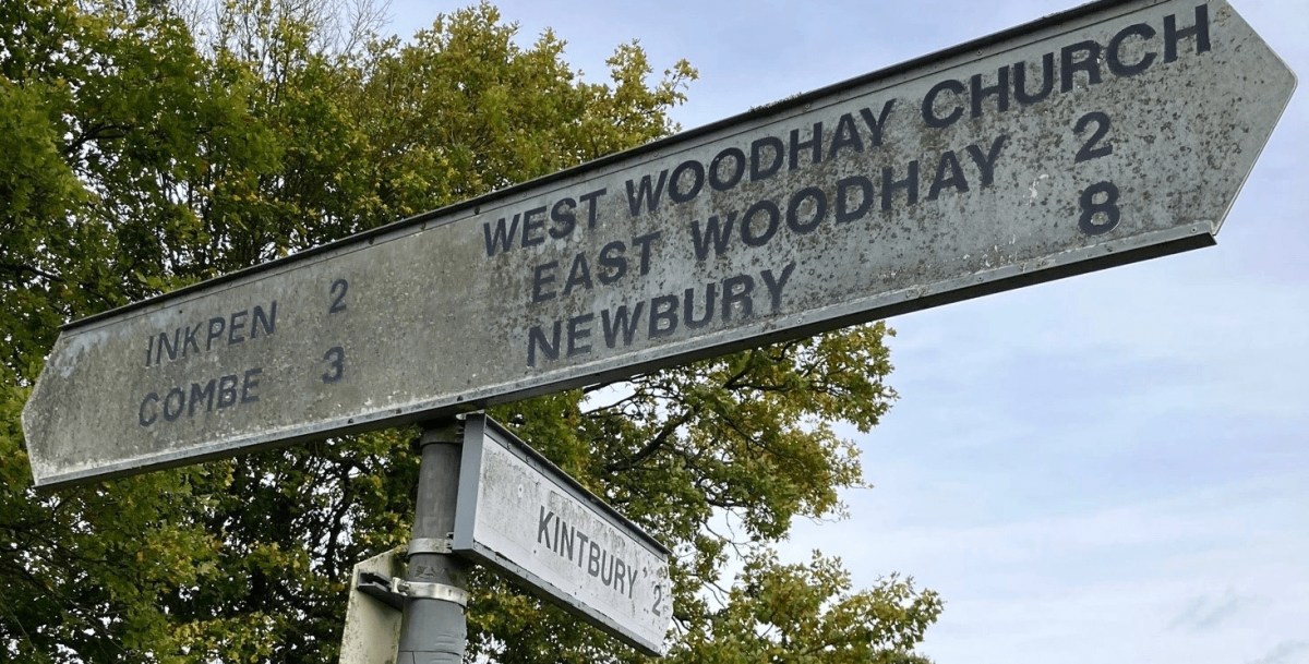
In July 1894 a Joint Enquiry was held by representatives of the County Councils of Wiltshire, Berkshire and Hampshire to define more conveniently the county boundaries between those three administrative areas. At that time, the boundary between Berkshire and Hampshire passed right through the middle of Walbury camp and just to the north of the gibbet, as you can see on old OS maps.

Representing Combe, the vicar – and also Poor Law Guardian – Rev George Pearson expressed the view that his parishioners would rather their village to be in Berkshire. It was easier to get to Hungerford than either Kingsclere or Andover for what the Newbury Weekly News reported as “magisterial” purposes and for paying the rates into the Hungerford Bank. Questioned as to where the nearest Union (or workhouse ) was in Hampshire, the Rev Pearson explained that the one in Kingsclere was 10 or 11 miles away across difficult roads. Other members of the Enquiry concurred with this.

Absent from the meeting was Mr A.C. Coles, Combe’s representative of the landed gentry and, presumably, the most significant person in the community. However, his representative, a Mr Browning, informed the enquiry that Mr Coles was anxious that the parish should be transferred to Berkshire as it would be more convenient for highway purposes and that there were only one or two paupers in the parish, anyway.

I have to say the precise significance of this remark is lost on me, although  I would hazard a guess that the implication is that the poor of Combe are not going to be a drain on the rates of those in the Hungerford Union area.

And so, in this rather prosaic way, Combe – despite being on the other side of the one-time mountain and highest point on chalk in England – came in to Berkshire and turned its back on Hampshire. Its ninety-something inhabitants, from the Coles in the manor house to the two paupers in their cottages, moved without going anywhere because the roads into Hungerford were better and more convenient despite the climb up and over Walbury Beacon. The boundary was redrawn so that Berkshire included Combe Wood and Eastwick and there it has stayed ever since.

St Swithun’s church stayed in the diocese of Winchester, at least for the time being. In the years that followed it was transferred to the diocese of Salisbury and then back again, moving eventually to the diocese of Oxford in the early 1960s.

I have heard of other reasons being given for why the county boundary across our benefice was moved. However, I can find no other reasons other than those given above – essentially the convenience of road communications between Combe and Hungerford in implementing the 1894 Act.

I would love to hear from anyone else who might know or have evidence otherwise!

Tessa Lock

This article was first published in “The Beacon” in 2022

In the time of the Romans

Imagine our area over sixteen hundred years ago in the fourth century AD. For three hundred years the country has been ruled as part of the Roman Empire and the local Celtic tribe, the Atrebates, now have a good working relationship with the incomers.

Imagine our area over sixteen hundred years ago in the fourth century AD. For three hundred years the country has been ruled as part of the Roman Empire and the local Celtic tribe, the Atrebates, now have a good working relationship with the incomers.

The regional centre is at Calleva Atrebatum (modern Silchester) – a town in the traditional Roman style but with a name reflecting the presence of the Iron Age people who were here first. Out here to the west, our area is close to the main route from Calleva to Aquae Sulis (modern day Bath) where the hot springs are an attraction to visitors. The route passes through the settlement of Spinis, which today we know as Speen.

For those living closer to this major road, the ranks of Roman soldiers, their helmets and shields glistening in the pale sunlight, have been a familiar sight. The men are not all from Rome, of course – far from it. The Roman army recruit from all over the Empire – across Europe and even North Africa. Sometimes local men from the indigenous Celtic tribes have signed up too, attracted to the idea of gaining Roman citizenship with all its advantages if you were able to complete a long period of military service, as well as the chance to travel and see the world.

Those who have travelled beyond our valley, or have spoken to others who have done so, speak of towns where the buildings are of stone with heating actually under the floor, where there is drainage and streets paved so that you are not deep in mud as soon as you leave your dwelling. This is the Roman way, and it all sounds very attractive and modern.

Indeed, some local people are wanting a piece of this new, improved lifestyle for themselves. There has been talk of local, Celtic women who have, despite family opposition, married young Roman men. Perhaps they have been attracted by the striking uniform or the offer of a more comfortable home. Who knows. But you do not have to marry into a Roman family to adopt this new way of living. Wealthier Celts have been increasingly adopting Roman ways.

Although there were no major Roman towns in our immediate area, we know that  those who were influenced by Roman ways did live in our valley. These people may have been exclusively of Roman descent, although it is more likely that they were Romano-British and therefore of possible mixed heritage or of Celtic descent but influenced by Roman ways.


Between 1950 and 1951, a teacher from St Barts Grammar School, Douglas Connah, led an excavation of a site which had been uncovered following work at the sewage works to the east of Kintbury. The excavation revealed the rectangular ground plan of a fourth century bath house, unfortunately badly damaged by ploughing and robbing out of much of its stone.

The building measured 5.25m by 4.04m with an extension to the south. At the east end was evidence of a praefurium, or furnace, to facilitate heating via a hypocaust which had been cut into the natural chalk and was still, at the time of the excavation, covered by a layer of wood ash. The building had been constructed of large flints and the lower courses of sarsen stone.

Painted plaster remains, now in West Berks Museum, indicated that the walls of the building were originally decorated whilst several tesserae suggested that there had once been a mosaic floor. It was possible to date the building to the fourth century due to pottery and a fibula brooch found in a rubbish pit nearby.

A tessera found near Irish Hill, outside of Kintbury

Although the bath house, as excavated, appeared not to have been joined to another building, it would not have been built in isolation but as part of a villa complex. It could have been on the site of a prosperous farm or indeed at the centre of a large estate. We may never know. But it is clear that sixteen hundred years ago, someone from around here wanted to build a modern, fashionable house with the latest in painted walls and mosaic flooring, and, of course, central heating.

It is sad for us that the remains of the accompanying villa have long been destroyed, most likely when the canal was constructed in the early 19th century. What happened to the broken remains of the roof tiles, the wall plaster, the tesserae? Who knows, keeping a sharp eye open when you’re walking towards Hamstead Marshall from Kintbury, you just might spot something of interest.

Tessa Lock