Defending the border? The view from Walbury Hill

The view from Walbury Hill

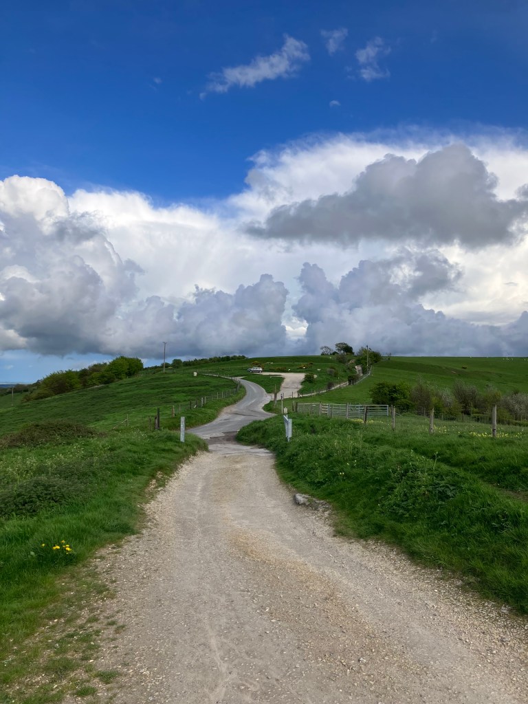
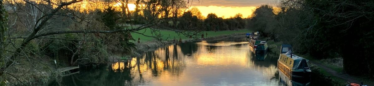
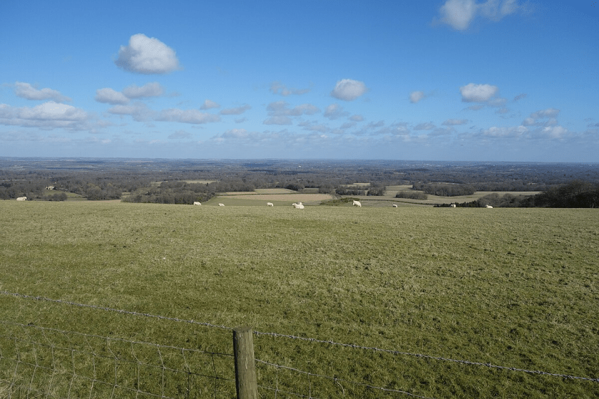
At present I am writing this as I look out at my garden on a particularly hot day. I am in Berkshire, or, if you prefer, Royal Berkshire. Less than three miles from my garden fence is Hampshire and I can look out of my bedroom window at Wiltshire. If I were to stand on my roof, I would see, three miles to the south, Walbury Hill, the highest point on chalk in England.

This wider area is often described as Central Southen England, although I like to think that, in our corner of West Berkshire, we look much more towards the west than towards Reading and the south east.

Berksshire and surrounding counties before 1974

My local authority – the one responsible for emptying our bins, amongst other things – is West Berkshire, based in Newbury. Before 1998, when West Berkshire became a unitary authority, our local authority was Berkshire, based in Reading. The Berkshire, that is, which was considerably smaller than it had been before April 1974, when the Vale of the White Horse in the north of the old shire county was transferred to Oxfordshire, and Berkshire gained Slough, previously in Buckinghamshire.

West Berkshire from 1974
Image:Nilfanion under Commons Licence, accessed from Wikimedia

Some people, with both a sense of history and also an ironic sense of humour, like to call the Vale, “occupied North Berkshire” – a nod to the feeling that Berkshire’s border with Oxfordshire should be along the Thames as it had been for hundreds of years.

The Upper Thames: The Berkshire/Oxfordshire border? Or perhaps the frontier between Wessex & Mercia?

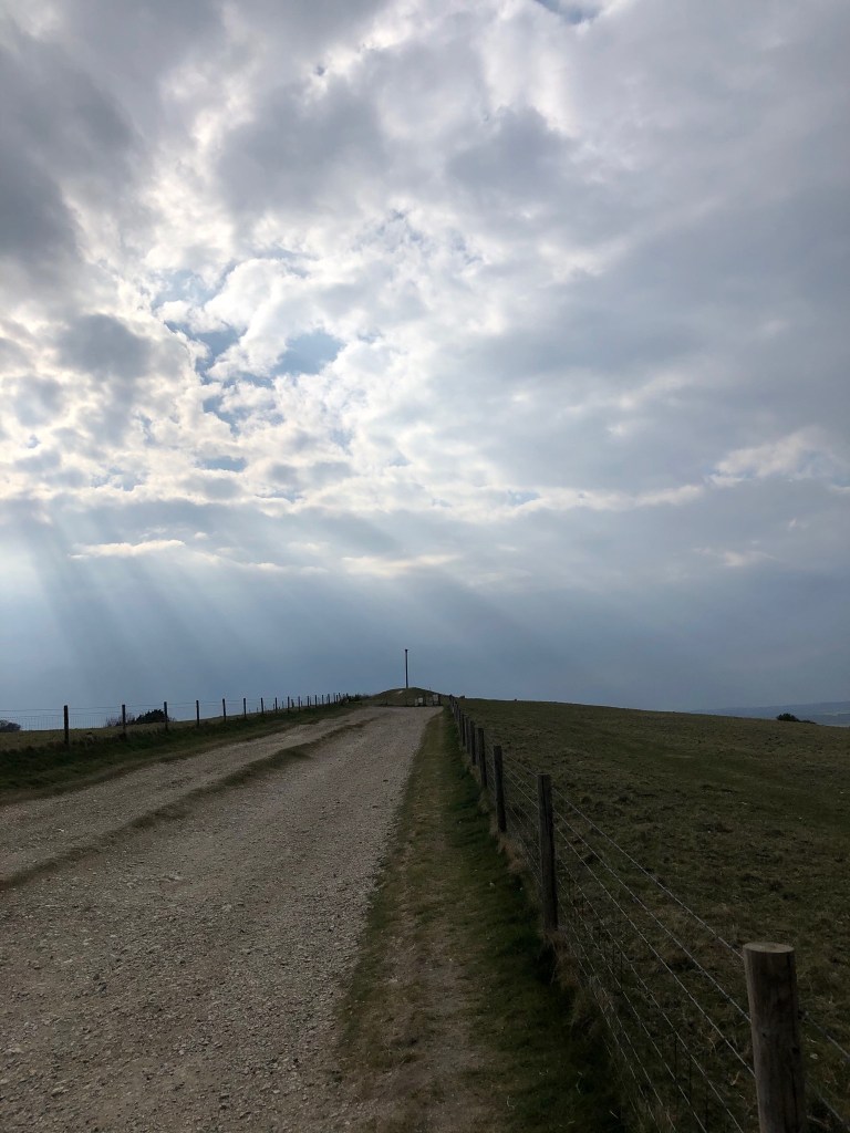
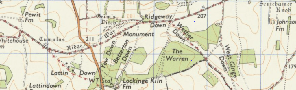
However, very soon our local authority will be changing yet again. It may, although at the time of writing, this has not yet been confirmed, be known as Ridgeway, named for the prehistoric track that runs east to west across the Berkshire Downs. The Berkshire Downs, that is to say, the downs currently partly in Oxfordshire after Vale of White Horse – formerly in north Berkshire – was transferred to Oxfordshire following the local government reorganisation in 1974.

The Ridgeway on the OS map

So, when – and if – we become “Ridgeway”, our devolved local authority will once more include the Vale, although people living there – for example in Uffington  – will still be in Oxfordshire as far as their postal address is concerned. Furthermore, the Thames will once more become the border between our local authority and whatever the devolved authorites to the north are finally called.

Confusing? Definitely. But this is definitely not new.

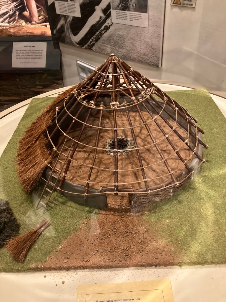
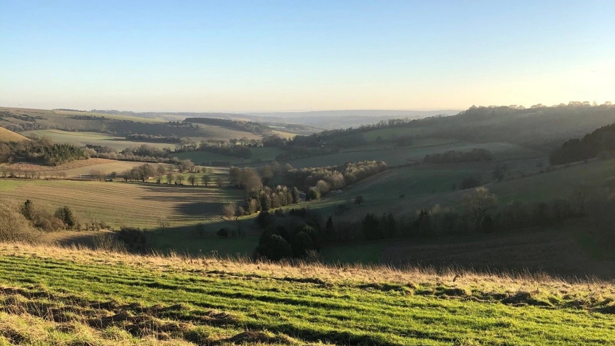
To consider the long view – the very long view – we need to travel back in time over two thousand five hundred years to the Iron Age. The hill fort on Walbury Hill – which I mentioned in my opening paragraph -is home to people known to the Romans as the Atrebates. We will never know how they identified themselves because the Atrebates did not have a written culture but valued committing ideas and stories to memory instead.

If a man or woman from that hill fort were to stand on the highest point of Walbury Hill and look across the Kennet Valley, all the territory below would, perhaps reassuringly, belong to their tribe. In the far distance to the north west, was the territory of the Dobunni, and to the distant south, the Belgae. Of course there was no signage back then; no, “You are entering the territory of the Atrebates” although the locals may well have known that a particular river or ditch marked the boundary between Us and Them. Indeed, the very existance of a hill fort on a prominent ridge would have of itself made a statement visible for miles around.

Emil Reich
Map by Emil Reich. Under Commons Licence accessed from Wikimedia

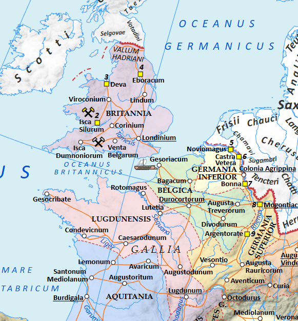
Our area at the time of the Romans. Spinae may be modern day Speen and Cunetio is near modern day Marlborough

The arrival of the Romans in Britain around 55 BC brought some obvious changes. For the people of the Atrebates, their tribal centre at Calleva, ( modern day Silchester ) became an important Roman town. In the valley below Walbury Hill, the construction of the road to Aqua Sulis ( the Roman name for Bath ) would have seen an increase in traffic. Villas appeared in the landscape, as at Kintbury. Trade with the newcomers meant an increased variety of  foods and other goods.

We do not know for sure if anyone was still living in the hill fort on Walbury Hill when the Romans arrived. We do not know, for sure, if any Iron Age man or woman, standing on the highest point on chalk in southern Britain, would have felt threatened by the increasing presence of the Romans in the valley below. We do know that it has to be likely that many Iron Age Celts continued to live pretty much as they had done before Caesar landed in Kent and continued to do so long after.

Roman province of Britannia. (Map of the Historical Atlas of Gustav Droysen, 1886) Under Commons Licence accessed from Wikimedia

It may well be that, being impressed by the site of Roman soldiers marching through the valley below, young Iron Age Britons were persuaded to join up. As Roman soldiers and with the promise of Roman citizenship after a long period in military service, they would have identified as Roman. Perhaps they would have served in the north of the country or even abroad and maybe they began to view the world below and beyond Walbury Hill as part of something greater – as part of the Roman Empire. We will never know for sure, but, human nature being as it is, this has to be a possibility.

Part of North West Roman Empire

Fast forward some four or five hundred years. On a clear day it might have been possible to spot some activity in the valley below Walbury  just to the west of what is now Inkpen.

Director General of the Ordnance Survey, UK. Under Commons Licence accessed from Wikimedia

To the left – or west – of the map above, “Wodnes Dic” is the earth work we know today as the Wansdyke. The crossed swords symbols at Ellandun, Beranburgh and Bedwyn indicate that this area sawconflictds during this period, known as the “Dark Ages”.

Part of OS map showing Inkpen and the eastern end of the Wansdyke

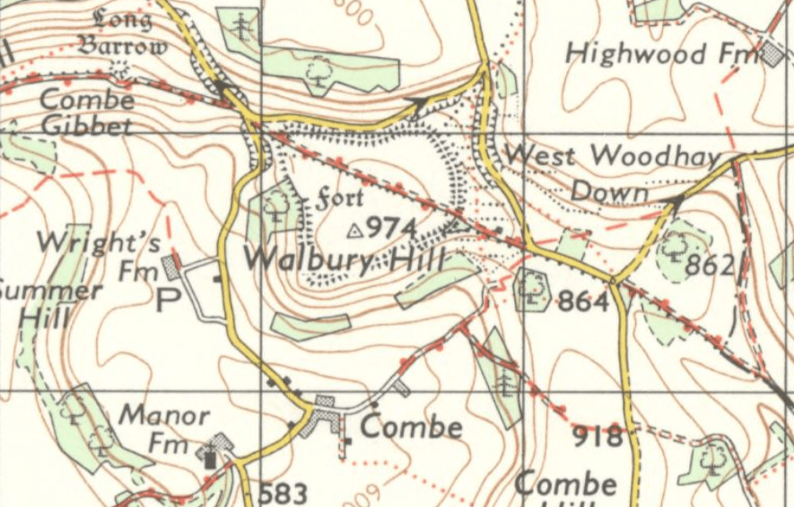
If you look carefully at modern editions of the OS map for this area, and you will see a track running north to south and just to the east of Lower Spray Farm, Inkpen, at grid reference SU 35170 63746. This is Old Dyke Lane, marked on the map as an earthwork and as a scheduled ancient monument.

Despite the name “dyke”, Old Dyke Lane has nothing to do with drainage, neither is it a scheduled ancient monument just because it is a lane. On some maps, Old Dyke Lane also has the word, “Wansdyke” printed in Old English script, which gives a clue to its historic importance.

The Inkpen section of the Wansdyke is in fact the very eastern end of “Woden’s Dic” – defensive ditch and bank running all the way from Portishead near Bristol, right across Wiltshire and concluding just over the border in what is now Berkshire. In places the bank is at least 4 meters high with the ditch being 2.5 meters deep although when first constructed it is likely to have been both higher and deeper. As the ditch is on the north side of the bank, it is likely that the Wansdyke was built by those living to the south of it for defence against those living to the north.

When first constructed, the bank may have had wooded revetments and a walkway; certainly the chalk of the freshly constructed bank would have been bright white, making a definite statement in the landscape and very likely visible from the hills above.

Constructing such a defensive work as this, at a time when there were only primitive excavation tools available, must have been a colossal feat, so who would have been responsible and whom were they defending themselves against?

There had been suggestions that the Wansdyke was constructed by the Romans but now this idea has been challenged. However, although Roman authority departed Britain around 410 C.E., that did not mean that every last Roman marched to Dover, waved goodbye and got on a boat heading to Italy. By the early fifth century, many who had originally arrived with the Roman army had formed relationships with the indigenous Britons whose culture and way of life had endured despite the occupation. So, by the fifth century, many people could be described as “Romano-British”.

There are, of course, very few written documents from this period of British history and what there are were written by clerics and the religious. Gildas was a monk writing in the 6th century CE and a very early chronicler of British history – although not necessarily a very accurate one.

Gildas believed the Wansdyke was constructed by one Ambrosius Aurelianus, a fifth century Romano-British military leader who fought against the Anglo Saxons as they advancing towards the south west from the north.

The Welsh cleric, Geoffrey of Monmouth was an eleventh century historian with a particular interest in the Arthurian legend. He elaborated on the story of Ambrosius Aurelianus, describing him as the uncle of King Arthur, no less. 

King Arthur Asks the Lady of the Lake for the Sword Excalibur, illustration by Walter Crane. Under Commons Licence, Accessed from Wikimedia

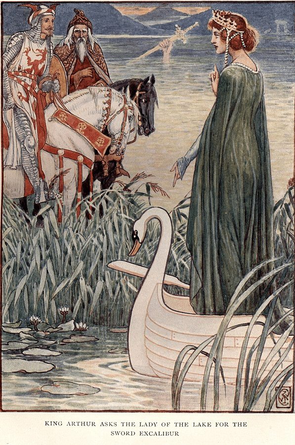
It is, of course, completely fanciful to think of the Wansdyke as having any connection – even remotely – with King Arthur. However, it may well have been constructed in the Dark Ages – the time in which the Arthurian legends are set – by Romano- British people as defence against aggression coming from the north.

Alternatively, some archaeologists believe that the Wansdyke could have been constructed in the 8th century by West Saxons as a defence against the Mercians, attacking from the area of the River Severn and Avon Valley.

We can – almost – be certain that the section of the Wansdyke in this area would have been constructed, at least in part, by local people who would have felt the need to defend themselves. Whether those people would have indentified as Romano-British or West Saxon, we shall popbably never know but we can deduce that they felt the need to construct a defensive border to define and defend their territory.

By the 6th century CE, the Anglo-Saxons – incomers from the European mainland – were the dominant authority in what is now England. In our part of the country, that is to say the south and south west, it was the West Saxons who held sway, and our area came to be known as Wessex. For most of this period, the River Thames was the border between Wessex and the Saxon kingdom of Mercia which stretched up into the Midlands.

Cross-border relationships were tense: leaders on each side wanted hegemony over the other Saxon kingdom, and there were frequent battles. A West Saxon person, standing on Walbury Hill and looking northwards, could have regarded the distant hills as enemy territory, to be defended. However a decisive engagement is believed to have come in 825 when Ecgberht of Wessex defeated Beornwulf of Mercia at the Battle of Ellendun, near what is now Wroughton in modern day Wiltshire.

Although relations between those identifying as West Saxons and the Mercians north of the Thames might have become more peaceful, there was to be another potential threat.

 Larson, Laurence Marcellus, 1868-1938 Under Commons Licence, accessed from Wikimedia

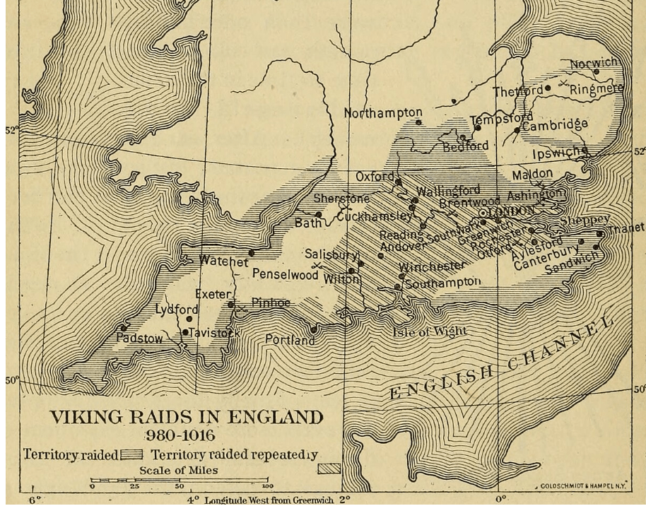
The Vikings had begun to invade and attack towns and villages on the north east coast of what is now England in the late 8th century. The term, “Viking” means pirate or raider and is often used to describe any raiders from what is now regarded as Scandinavia. The raiders from Scandinavia who attacked Wessex in 871 are more accurately referred to as Danes and these are the invaders defeated by (almost) local man, King Alfred at the Battle of Ashdown in 871.

“King Alfred” Photo: Bill Nichols Under Common Licence accessed from Wikimedia

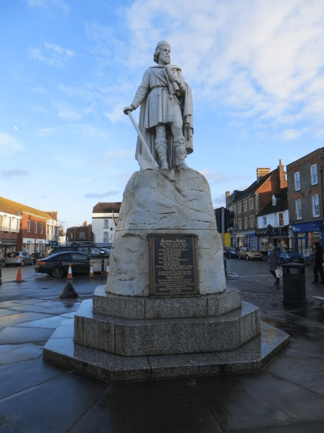
Alfred had been born in Wantage – or Wandesiege as he would have known it – sixteen miles to the north of Kintbury across the downs, in 849. As well as effectively seeing off the Danish threat, King Alfred did much to improve standards of literacy and education in his kingdom and also revised the legal system. He remains the only British monarch to be known as, “the Great.”

By the beginning of the tenth century, a man or woman standing on Walbury Hill would have been looking at Wessex to the north, to the south, to the east and to the west. Now the Kingdom of Wessex was one of the most powerful in what was being called Enga land.

Anglo Saxon Wessex: Informatiion based on Hill, An Atlas of Anglo-Saxon England Under Common Licence accessed from Wikimedia

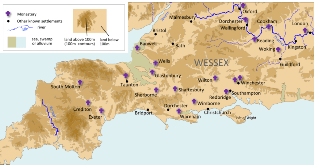
The Saxons were responsible for dividing up the country into administrative areas we know today as counties. Berkshire exists from sometime in the 9th century.

Berkshire in the 17th century. National Library of Scotland

By the Norman conquest, I think it is safe to say Berkshire was a county of size and shape we could identify at least as looking something like the pre 1974 county. However, the final details were not set in stone.

Detail from map of Berkshire, 1830, by Sidney Hall. Note Shalbourn & Oxenwood shown as being in Berkshire (National Library of Scotland)

The 1894 Local Government Act resulted in some smaller towns and villages moving from one authority to another. (See my earlier post, “Where in the world is Combe?”)

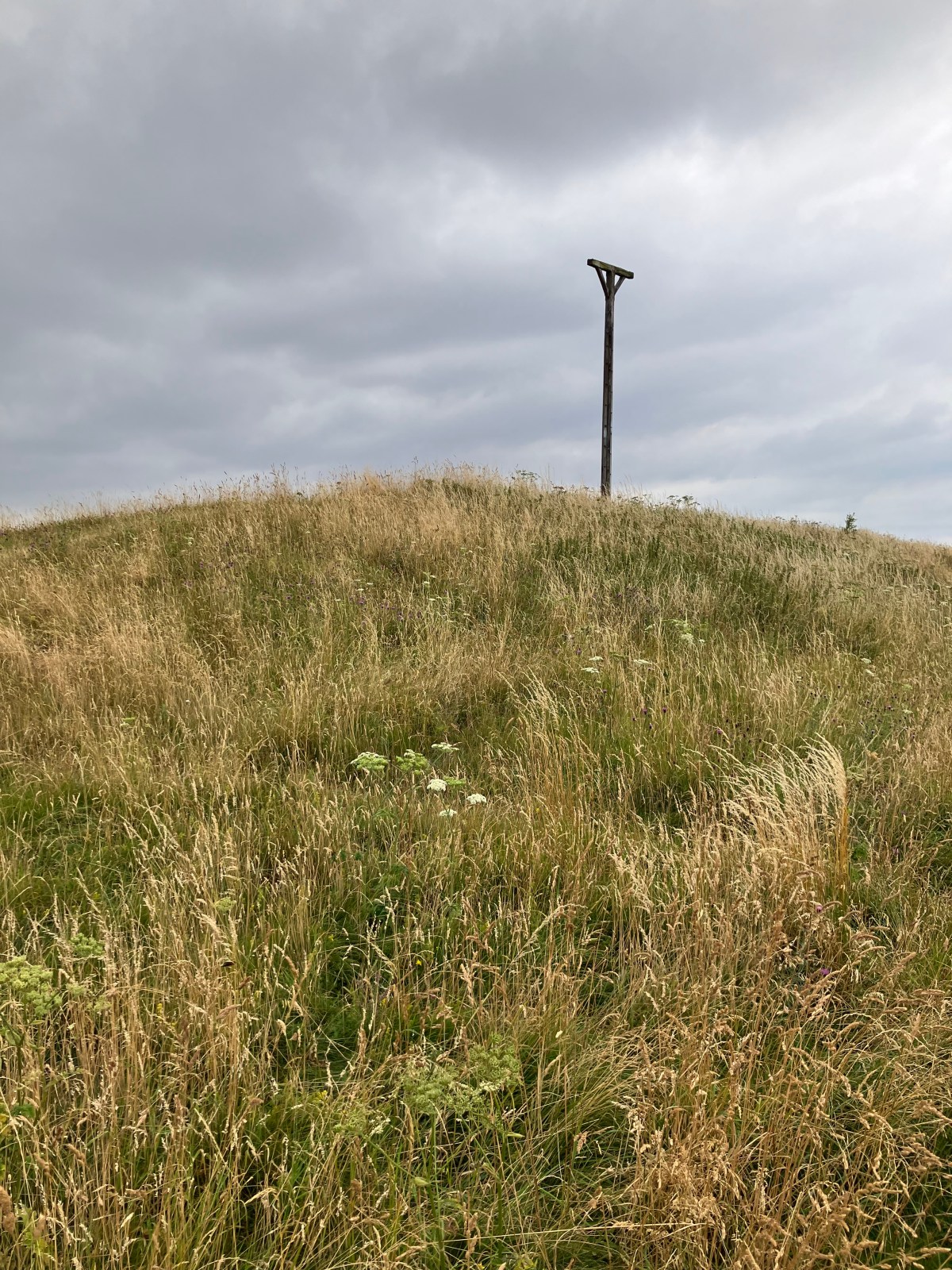
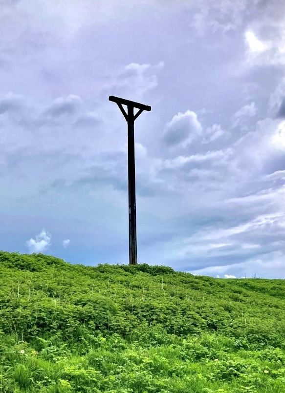
Until 1894, the border between Berkshire and Hampshire ran across Walbury Hill. Combe Gibbet was just inside Hampshire as was the village of Combe. The intention of the Local Government act was to enable the public – by which was meant certain men over 21 – to vote for local and district councillors. Districts were defined by a consideration of certain factors which included not only population but proximity to magistrates courts, banks and poor law unions ( or workhouses.) And so it was decided that for Combe, Hungerford in Berkshire was nearer and more convenient than Kingsclere in Hampshire. The boundary was redrawn therefore, so that Combe and Walbury Hill, along with Combe Gibbet, should be in Berkshire.

But, as far as I am aware, none of these changes were accompanied by violence. In 1894 the good burghers of Charnham Street, Hungerford did not have to defend themselves against Berkshire taking it by force from Wiltshire. And no one in Combe sharpened their pike staffs and marched up Walbury Hill to repel similar forces from Inkpen and Kintbury.

Although the redrawn border between Hampshire and Berkshire was not done for defensive purposes, certain measures taken in 1940 definitely were.

Part of OS map, 1945 showing defences of Britain

After the defeat at Dunkirk in 1940, Britain faced the severe threat of invasion. Plans were made to delay the German forces should they actually invade, to which end a series of defensive constructions were eventually built which included concrete “pill boxes” at locations along the Kennet & Avon – known as “Stop Line Blue” – and also the Thames. They would be manned by Local Defence Volunteers – men unable for whatever reason to join the regular forces but who could contribute to defence.

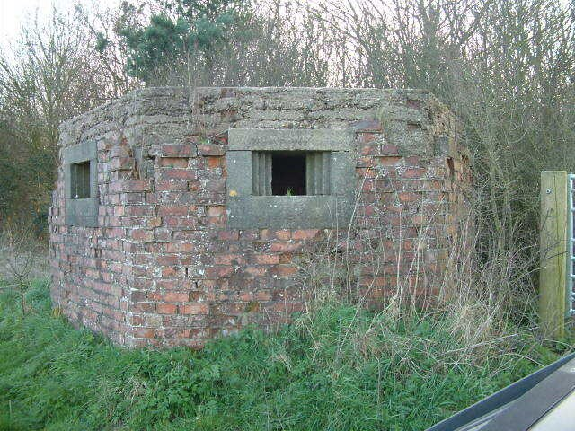
Thankfully, there was never an invasion during World War II and so the pill boxes were never used to defend a border. But it is a chilling thought that, if an invasion had been succesful, the Kennet & Avon canal, or even the Thames, could have become the border between a free England and the occupied sector.

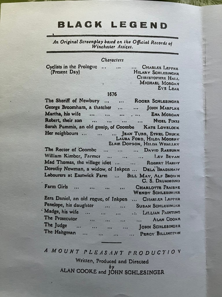
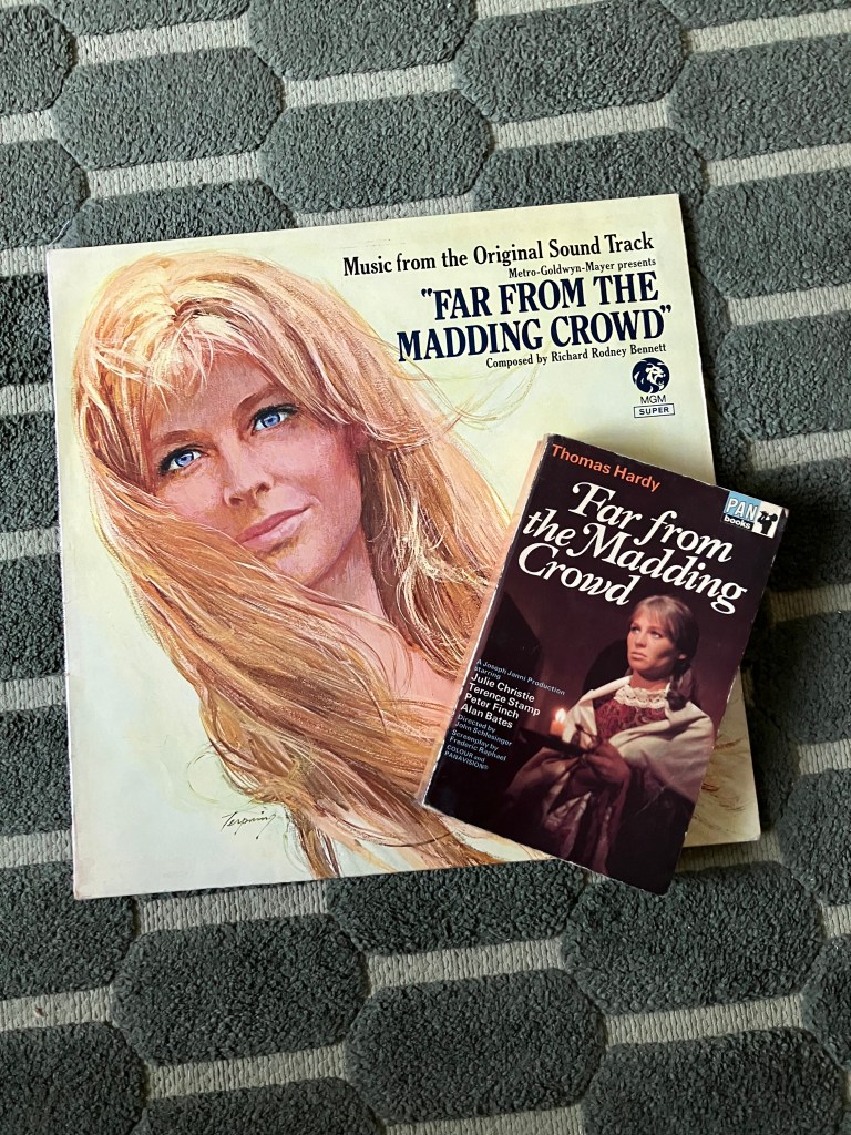
Interestingly, the name Wessex has endured even though Alfred’s Kingdom has long gone. It is as if many of us still take a kind of atavistic pride in living in what was once a very powerful part of England – and perhaps also a very beautiful one. I believe the novelist Thomas Hardy was in part responsible for the resurgence of Wessex as an idea, if not strictly a geographic location, when he used it as locations in his novels.

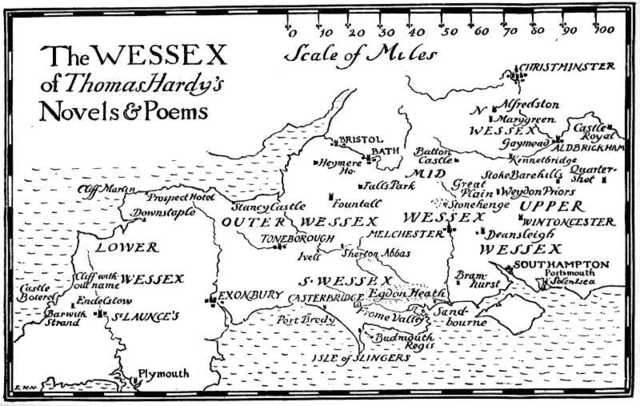
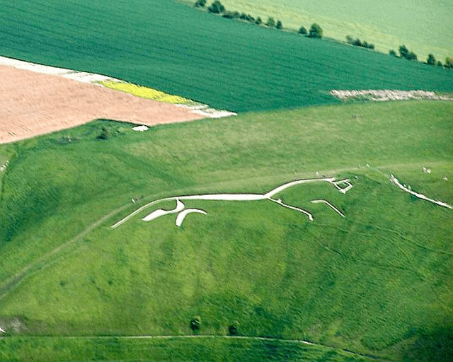
Speaking for myself, I quite like the name “Ridgeway” and I hope that is what our authority will be called. Alternatively, I rather like “North Wessex” as Thomas Hardy called this area in his novels. But whether we are Wessex or Ridgeway, West Berkshire or Royal Berkshire, Walbury Hill – our highest point in chalk in England – will still be there, and the White Horse will still be galloping over the downs above the vale

White Horse from the air: Dan Huby Under Commons Licence .accessed from Wikimedia

(C). Theresa A. Lock 2025

Sources:

http://www.wansdyke21.org.uk/faqs.htm https://howardwilliamsblog.wordpress.com/2022/10/24/exploring-east-wansdyke

Our Neolithic neighbours

So who were our neolithic neighbours?

It is mind boggling to think of people living in this area over 6000 years ago. However, if you know where to look for it you can still see evidence of those people who lived around here between c4000 and 2500 years BC in the neolithic period.

The neolithic, or new stone age, was the period which saw a more settled way of life with the domestication of plants and animals and the beginning of farming rather than a hunter/gatherer life style.

During this period there were communal constructions of large scale earth works, banks and ditches. The famous henge monument at Avebury dates from this period.

But where is the evidence that neolithic people once lived in this area?

A favourite local destination for many of us in our area is Combe Gibbet above Gallows Down, close to the highest point on chalk in England and affording spectacular views particularly to the north across the Kennet valley. Standing right next to the gibbet we admire the view and identify local landmarks. It is an uplifting and spectacular spot.

But is there something that we miss? I know I did when I first walked up to the gibbet. As it stands on one of the highest points of the hill, it is easy to overlook the fact that the gibbet has been erected on a mound. The mound on which it stands is actually a neolithic long barrow.

There are around 500 neolithic long barrows in England of which three are in Berkshire and many more over the borders in Wiltshire and Dorset. Generally speaking most are in the Cotswolds or Wessex.

Our local barrow is oriented east to west and measures 65 meters by 20 meters and is surrounded by a ditch about 7 meters wide. Constructing it was no mean feat particularly when the only tools available were made from bone or flint and would have required a well-organised and dedicated work force.

But why was it built up here?

Long barrows were important communal burial sites during the neolithic. A chamber was usually constructed of wood or stone with an entrance at one end, then covered over with earth. Members  of the community were laid to rest in the tomb but, in a practice that seems strange to us, often only certain bones were placed within and it seems likely that the remains were, at times, taken out and replaced.

It is likely that the long barrow would have been an important ritual site for the local community and might have indicated ownership of a particular area by a particular group of people. A location commanding an impressive view seems to have been important; for example, Wayland’s Smithy Long Barrow near Uffington and West Kennet near Avebury are also sited on higher ground.

The long barrow above Gallows Down was likely to have been the focus of communal events. However it may well be that our neolithic neighbours would have travelled further afield to meet up with other family members or community groups; the henge and stones at Avebury could have been reached by following the river Kennet westwards, for example. We know that neolithic peoples often travelled hundreds of miles to join in the ceremonies at Stonehenge so the thirty or so from here across Salisbury Plain would have seemed any easy journey to people used to walking long distances

So, as we traipse up to the gibbet and admire the view, perhaps we should remember that beneath our feet is a construction that would have been important to our neolithic neighbours – something that would have been revered and respected, which had taken much time and effort to build. After all, we can not imagine a time when we would walk through Winchester Cathedral whilst ignoring its significance as a place of worship, or pass Windsor Castle without seeing it as something just a bit special.

Our local long barrow, up above Gallows Down, might not look particularly important to us now, but it is worth remembering that 6000 years ago it might have been the most significant thing in the landscape.

(C) Theresa Lock 2024

From a dig at Inkpen to the skies above Stonehenge:

O.G.S. Crawford – the man who put history on the O.S. Maps

I have always enjoyed looking at Ordnance Survey maps – to plan routes for days out or just afternoon walks, or simply to see the names of woods, rivers, hills or countless other features all carefully recorded. But for me one of the most fascinating features of O.S. maps are those places labelled in a gothic or Old English font which indicate a site of historic or archaeological significance. “Walbury”, “long barrow” ( on Gallows Down ) and “moat” ( at Balsden Farm ) are all good examples from the Kintbury area.

Although the Ordnance Survey started publishing maps over 200 years ago, originally for military purposes, it was not until the 1920s that historic and archaeological sites were first identified as they are now. And the person first responsible for including that information had an interesting connection with our area.

Osbert Guy Stanhope Crawford was born in 1886 in Bombay, India where his father was a judge. However, as his mother died soon after his birth, he was sent back to England to live in London with two of his aunts. While the young Osbert was still of school age, he moved with them to The Grove, East Woodhay, a few miles from Kintbury and just over the border in Hampshire. Later the Crawfords relocated to Tan House, Donnington, just outside Newbury.

Crawford was educated at Marlborough College in Wiltshire and it was there that his interest in archaeology grew. As a member of the College’s Natural History Society, Crawford visited various Wiltshire archaeological sites such as Stonehenge, West Kennet Long Barrow and Avebury.

From Marlborough, Crawford went up Oxford University where his interest in archaeology continued. In 1908, whilst still a student, he excavated a Bronze Age round barrow at Inkpen, not far from his aunts’ East Woodhay home, as well as other – possibly less successful – work excavating at Walbury Beacon.

It was around this time that Crawford became friends with archaeologist and anthropologist Harold Peake and his wife Charlotte, excavating with them at Botley Copse near Marlborough. Harold Peake is particularly remembered in this area as being curator of the Borough of Newbury Museum from 1867 to 1946 and the person responsible for building up an important collection for what was later to become the West Berkshire Museum.

The Peakes lived at Westbrook House, Boxford, just to the north of Kintbury. Their interests included not only archaeology and anthropology but music, folklore and drama and they were very supported of younger people such as Crawford. It is believed that, under Peake’s influence, Crawford began to question the kind of extreme religious beliefs held by his aunts, in favour of a more science-based world view.

After graduating from Oxford, Crawford worked as an archaeologist in both Britain and Sudan. During the First World War he served as a photographer with the Royal Flying Corp but spent time in a German P.O.W. camp, having been shot down.

In the 1920s, Crawford worked for the Ordnance Survey in Southampton, as its first Archaeological Officer. It was around this time that historians and archaeologists began to use aerial photography in identifying and interpreting historic sites which could no longer be seen clearly above ground. The remains of structures and earth works which have long disappeared can be identified through crop marks and shadows which can then be studied using aerial photographs. Crawford’s time with the Royal Flying Corp would have given him first hand experience of how useful such photographs can be.

Crawford used the study of aerial photographs as well as information gathered from local antiquarian and historical societies to identify the locations of many ancient monuments which would not have been visible to cartographers working in the field. He also conducted his own surveys, often travelling across the countryside on his bicycle. Crawford then annotated each O.S. map by hand, adding the names and locations we are now familiar with but which today are identified on our maps in a gothic font.  

At this time, Alexander Keiller, heir to the family fortune made in  marmalade, was living at Avebury Manor. An amateur archaeologist, he had been involved in excavating the world-famous neolithic henge and other associated sites. In 1924 Crawford joined Keiller in an aerial survey of Wiltshire and Somerset as well as Berkshire, Hampshire and Dorset and in 1928 they published Wessex From The Air, a groundbreaking aerial photography survey of our area and the landscape of the wider Wessex.

Crawford assisted Keiller in the fund raising which enabled Stonehenge to be bought for the nation, and in 1927 he founded the influential archaeological journal, Antiquity.

Keiller worked for the O.S. until 1946 when he turned his attention to the preservation of those historic buildings in Southampton which had survived the devastation of the blitz during the Second World War.

Today, O.G.S. Crawford is recognised as an important figure in twentieth century archaeology. It is interesting to think that this important career began in part with an excavation at Inkpen and a friendship in Boxford.

Crawford died in 1957.

Sources:

https://www.ordnancesurvey.co.uk/about/history

https://historicengland.org.uk/images-books/archive/collections/aerial-photos/

https://hantsfieldclub.org.uk/ihr100/profiles-c/crawford.html

https://www.sarsen.org/2018/04/capturing-material-invisible-ogs.html

© Theresa Lock 2024

Walbury: Living in an Iron Age hill fort

On the highest point on chalk in England, Walbury Hill Fort has overlooked the Kennet Valley for over two thousand years.

During the Early Iron Age, between 700 and 300 years BC, around three to four thousand hill forts were constructed throughout Britain. It is difficult to say exactly why there was an increased need for more fortified settlements but a rise in population might have led to competition for resources coupled with an emergence of powerful, local chieftains looking to defend their patch. The Iron Age people – or the Celts as they are sometimes called – are known to have been quite aggressive and defensive of their territory. Three distinct tribes occupied the central south west of England – the area often identified as Wessex – with the Durotriges in the south , the Dobunni to the west and, in our area, the Atribates.

Looking towards Walbury Hill Fort today

The Iron Age Celts had no written culture themselves but instead valued the passing on of knowledge and poetry in the oral tradition. However, the Romans, who invaded Britain towards at the end of the Iron Age, had quite a lot to say – and write – about the people already living here. According to the Romans, the Celts were pale skinned and muscular. The men were fond of washing their blond hair in lime water to enhance its colour, then combing it back across their heads into spikes. Trousers and shirts of woollen cloth were dyed in bright colours and men of higher status chose to grow their moustaches so long their mouths were covered.

Metal working skills were particularly valued with decoration and ornamentation in the intricate swirling designs identified as being in the Celtic style still popular today.

Walbury was one of the earlier hill forts to be built. Constructed at a time when the only tools available were antler pick axes, shovels and wickerwork baskets, our local hill fort is trapezoid in shape and covers 82 acres or 33 hectares, making it the largest hill-fort in Berkshire.  It is univallate, meaning it is surrounded by a single bank and ditch and when originally constructed the bank would have been topped with a wooden palisade. In places the top of the rampart to the bottom of the ditch measures 5 meters so the whole structure would have been quite imposing.

Although it is impossible for us to know how many men were required to construct the hill fort, or how long it would have taken, it was clearly labour intensive and very important to them. When first constructed, the bare chalk walls would have been visible for miles around and, topped with a high wooden fence, it made a statement. It announced, “This is our space – we live and defend here.”  

Walbury was not alone in the landscape. From the highest point within the fort others could be seen including Fosbury near Kingsclere, Beacon Hill near Highclere and further afield Danebury near Andover and Segsbury near Wantage. Evidence of settlements and of farming have been discovered beyond the hill-top settlements and it is difficult to assess how much time would have been spent living within the defended enclosures rather than in homes clustered lower into the valleys.

Walbury was excavated in 1997 as part of the Wessex Hill Forts Project ( see link below ) but, disappointingly, a magnetometer survey failed to detect features such as post holes due to the variations in the natural geology. However, other, more successful excavations elsewhere have revealed more about hill-fort life in the Iron Age.

Professor Barry Cunliffe excavated Danebury Ring hill fort over twenty seasons in the 70s and 80s, revealing much about Iron Age hill fort life which must have applied to our local hill-fort dwellers at Walbury.

Model showing construction of Iron Age house, Museum of the Iron Age, Andover

Homes would have been round houses constructed of wood with wattle walls, one door way providing all the light inside. Agriculture was important with cattle, sheep and pigs kept not only for their meat but also milk, skins and wool. Grain, grown in fields outside the fort, would have been stored in square granaries or deep pits.

Agriculture was not the only industry: spinning and weaving, leather working, basket and hurdle making, pottery and metalworking were all of particular importance. Although life within the hill forts was pretty much self sufficient, by the first century BC, trade with the continent had increased with imports of wine, olives, figs and glass to the communities nearer the coast.

Model of Iron Age woman weaving, Museum of the Iron Age, Andover

Change was coming, however, with the arrival of the Romans in 55 BC and the following decades. Trade and collaboration with the newcomers eventually saw changes in the life style of the indigenous peoples many of whom began to adopt a more Roman way of living. Hill forts on their cold, windy ridges overlooking the valleys were eventually abandoned with many higher status Celts preferring a more Roman life style of living. Although it is now known that many Iron Age peoples continued to live as they had done for hundreds of years and quite independently of the Roman incomers, there would have been times, increasingly, when Celtic men and woman chose their partners from those more newly arrived – perhaps to family opposition or even perhaps to envy of the new, modern life style. Perhaps the inhabitants of the villa built close to the Kennet to the east of Kintbury may well have been a Romano British family who were the descendants of those people who had originally lived in the Walbury hill fort.

When, I wonder, was the very last time that an older family member looked towards Walbury and said to children or grandchildren,

“See that place on the hill? That was where our people used to live. That was our place!”

(C) Theresa Lock April, 2024

References and sources:

The Museum of the Iron Age, Andover

UnRoman Britain: Miles Russell & Stuart Laycock

The Time Team What Happened When ed Tim Taylor

Iron Age Celts in Wessex: David Allen

https://historicengland.org.uk/images-books/publications/wessex-hillforts-project/wessexhillfortschap02p39to130

From Combe Gibbet to Hollywood

Many people hereabouts are familiar with the story of the two young Oxford students who, in September 1948, set out to make their first feature film.

Filmed entirely on location around Inkpen and Combe with many scenes shot on Walbury Hill, the plot of the film is based on true events. These were the murders in 1676, of Combe ’s Martha Broomham and her son Robert, by Martha’s husband George and his lover, Dorothy Newman of Inkpen. The murderers were executed at Winchester and their bodies subsequently displayed on Combe gibbet.

Entitled, Black Legend, the film used actors drawn from, variously, members of Oxford University Dramatic Society, one young director’s family who lived locally, villagers from Inkpen & Combe and children from Christchurch School, Kintbury.

The weather that September was sometimes cold and bleak; shooting was held up when the camera broke and had to be sent away for repairs. However, the young men were pleased with their results, writing in the film’s accompanying programme notes:

But for all its failings we believe BLACK LEGEND to be an achievement that in one respect at least has rarely been equalled. For it shows how much can be achieved by the co-operation of enthusiastic people, even in a project so technical as a film.

Copy of the original programme for Black Legend

Were the young students right to feel so positively about their work? Well, when the finished version was shown – in Hungerford, Inkpen, Ashmansworth and West Woodhay the following January, 1949 – the Newbury Weekly News declared in its advertisement for the screening, “The Film YOU helped to make” and “YOU’LL BE SORRY YOU MISSED IT”.

In its review, the Newbury Weekly News quotes an anonymous film critic as saying:

“Black Legend is a film to see and remember…

The acting is a marvel of cooperation among amateurs, some skilled, some quite inexperienced, but all gifted enough to convey their thoughts and often their probable words without any speech.

Soon, Black Legend was to receive a wider audience than the villages around Newbury. An article in the Scotsman of March 1949 reports that it had been shown in the Grand Committee Room of the House of Commons. The film is now described as, “having all the cinema world by the ears.”

The report goes on to say,

“The wonderful landscape, the local people, the farms and their implements, are all so used … that the compositions are beautifully organised; the photography of these young people with relatively little experience resulting in a work which ought to make the film industry pull up its socks.”

These young men obviously showed promise: but did they fulfil that promise?

In 1965 one of those young men returned to film on the chalk downland not so very far from here. By now, John Schlessinger – whose family had lived near Kintbury in the 1940s – was regarded as part of the British “New Wave” of film directors and his previous movie, “Darling,” had been Oscar nominated.

This time, Schlessinger’s leading actors were  well known throughout the movie world of the early 1960s: Terence Stamp, Alan Bates and Julie Christie, although, as with Black Legend, his cast included many local people. “Far from the madding crowd,” an adaptation of the novel by Thomas Hardy, was to be filmed entirely on location – as Black Legend had been – this time in Wiltshire and Dorset. Just as Black Legend had featured music by Vaughan Williams to compliment the film’s rural setting, so Richard Rodney Bennett’s score for “Far from the madding crowd” is frequently reminiscent of Vaughan Williams’ work, similarly using variations on English folk songs to evoke the period and place of the piece.

Schlessinger’s “Far from the madding crowd” is one of my favourite films. It must be one of the most visually beautiful films ever shot in England and captures the Wessex downland like no other, in my opinion. So many shots, I feel, are reminiscent of scenes in Black Legend, almost as if Schlessinger was finally perfecting, on a much higher budget and in glorious technicolour, scenes he had shot with Alan Cooke on and around Walbury Hill, all those years before.

Iconic 60s star Julie Christie starred in Far From The Madding Crowd

Throughout his career as a film maker, John Schlessinger received four BAFTAs and an Academy Award (an “Oscar”). He was made a CBE in 1970 and a BAFTA Fellow in 2002.

He died in 2003.

(C) Theresa A. Lock 2024

References:

https://www.bfi.org.uk/features/where-begin-with-john-schlesinger

Newbury Weekly News Archive, West Berkshire Library

British Newspaper Archive

Say, ‘Hello’ to Marilyn

I have a vague memory from school geography lessons of being told that, if you draw a line which passes through the Bristol Channel in the south west and the Wash in the north east, everything above the line will, more or less, be in “upland Britain”, whilst everything below will be “lowland Britain”.

Staring at my Philips’ School Atlas and the page showing “British Isles – Political” this distinction did not seem quite right. A line drawn from Bristol to the Wash would leave much of Lincolnshire, a county with a reputation for flatness, in the “upland” sector, whilst much of Gloucestershire and the Cotswolds in the “lowland” half.

Perhaps I’d just got my line in the wrong place. However, it is indisputable that there are more uplands to the north and west. In Scotland, for example, mountains over 3000 feet or 914.4 meters are called Monros and there is a total of 282 of them. There is no way we in the south can compete with that. Climbers who complete all 282 earn the right to call themselves “Monroists” and join the Monro Society.

Down here in Wessex we might not be able to boast any mountains but that is not to say that our landscape is particularly flat. Not all of it, anyway.

A while ago, while researching something about hills in chalk downlands, I came across the term “Marilyns”. I thought this was a joke. So, if Scottish mountains are known as “Monros”, some wag decided to call certain hills, “Marilyns” after Marilyn Monroe” – get it?

But “Marilyns” are not a joke, although there is a certain humour in calling them that. The classification was first coined in 1992 by Alan Dawson in his book, “The Relative Hills of Britain” and refers to UK hills and mountains:

…with a prominence of 150m or more regardless of height.

Or to put it another way:

A Marilyn is a hill of any height with a drop of 150m or more on all sides.

Alan Dawson

And so our “local” hill, Walbury Hill is a Marilyn. Although it rises 974 feet above sea level, it is its prominence of 188m or 617 feet above the surrounding hills which is its qualifying factor. Neighbouring Marilyns are Butser Hill in Hampshire at 158m or 518 feet and Winn Hill in Wilshire at 159m or 522 feet.

There are 174 Marilyns in England and a total of 1556 throughout the UK where Walbury Hill comes in at number 107. Perhaps not much of a distinction for a hill that was once classified as a mountain by the Ordnance Survey in the nineteenth century. But we can still boast that our local Marilyn is the highest point in chalk in southern England!

Theresa Lock, November 2023

Sources including:

rhoc.uk/marilyns/

hill-bagging.co.uk/Marilyns.php

Once a mountain

Walbury Beacon Benefice is named after the point on Walbury Hill where, traditionally, a beacon has been built.

But mind-chains do not clank where one’s next neighbour is the sky.

Thomas Hardy, “On Wessex Heights

Walbury Beacon Benefice is named after the point on Walbury Hill where, traditionally, a beacon has been built. Originally beacons were lit across the south of England as an alert to the danger of invasion. More recently and at least since Victorian times, the chain of beacons has been lit to celebrate royal jubilees. Sometimes known as Inkpen Beacon, at 974 feet above sea level, Walbury Hill is the highest point on chalk in England and the site of Walbury Camp, an Iron Age hill fort, which, I believe, has never been excavated.

A beacon on Walbury Hill/Inkpen Beacon celebrating the Platinum Jubilee in June 2022

It will surprise some people to know that when the Ordnance Survey first surveyed this area, Walbury Hill was measured as being 1,011 feet above sea level, thus making it a mountain! However, a subsequent survey in the late C19th measured Walbury at less than 975 feet and so demoted it to the status of a hill.

Further westward along the ridge is Inkpen Long Barrow, one of only three long barrows in Berkshire but one of a cluster, most of which are located in Wiltshire and Dorset. However, it is not the long barrow that many visitors come to see, but the famous (or perhaps that should be infamous) Combe Gibbet.

Combe gibbet

Many people mistakenly believe that a gibbet was the site of a public execution, but this was not so. The original Combe Gibbet was only used once but it was not for an execution. In 1676, George Broomham and Dorothy Newman were convicted of the murder of George’s wife Martha and son, Robert. They were executed at Winchester but their bodies returned to their home parishes where they were hung on the gibbet – as a deterrent to anyone contemplating committing murder. What contributes to the general confusion between a gibbet and a gallows is the fact that the downland on the north side below the gibbet is marked on OS maps as “Gallows Down” – presumably a misnomer which has stuck!

As many of you will know, the story of Broomham and Newman inspired the then young Oxford graduate John Schlessinger, to make his first feature film, “The Black Legend”. In the late 1940s the Schlessinger family lived at Mount Pleasant, between Inkpen and Kintbury  and so the grisly local landmark would have been a familiar sight to them. With family members and friends from Oxford taking the major roles, John Schlessinger filmed the story of murder during the summer of 1948, using many local people as extras. I doubt any of these villagers had the remotest idea that this young man would one day go on to be one of Britain’s foremost directors winning 7 BAFTAs and an Oscar.

Nearly 20 years later John Schlessinger was to return to Wessex to film his adaptation of Thomas Hardy’s “Far from the Madding Crowd”. Filmed entirely on location in Wiltshire and Dorset, what fascinates me about this later work are the number of scenes which recall moments from Schlessinger’s earlier film. It is as if the inspiration he took from his work around Walbury Hill stayed with him and was used in this, one of the visually most beautiful of British films.

However, it is not only because of the Black Legend that many other people visit Walbury Hill. The Newbury Weekly News archive features various accounts of visits to the area or discussions of its history. Some time in the late C19th, the novelist and poet Thomas Hardy visited Walbury Beacon – though perhaps to confuse us even more, he calls it “Ingpen Beacon” – and referenced it in his poem, Wessex Heights:

There are some heights in Wessex, shaped as if by a kindly hand
For thinking, dreaming, dying on, and at crises when I stand,
Say, on Ingpen Beacon eastward, or on Wylls-Neck westwardly,
I seem where I was before my birth, and after death may be.

Walbury Hill might not be a mountain but it remains a much loved landmark.

Theresa Lock

Thomas Hardy and North Wessex

Think of the author, Thomas Hardy (1840 -1928), and your first thoughts are probably of Dorset, the county most associated with his life and where most of his novels and poems are set.

So, what did this author, most associated with the countryside around Dorchester, have to do with Berkshire?

Think of the author, Thomas Hardy (1840 -1928), and your first thoughts are probably of Dorset, the county most associated with his life and where most of his novels and poems are set.

Fans of Hardy will know that in his novels he identified his semi-fictional Dorset as South Wessex, Wiltshire as Mid Wessex, Hampshire as Upper Wessex and so on, adapting the name of the early medieval kingdom. If you look carefully at the map of Hardy’s Wessex inside most editions of the novels, you will see that North Wessex corresponds to pre 1974 Berkshire with “Christminster” or Oxford, just to the north.

So, what did this author, most associated with the countryside around Dorchester, have to do with Berkshire? Well, Hardy’s paternal grandmother, Mary Head, was actually born in Reading and brought up in Fawley, a village on the downs south of Wantage. In his novel, Jude the Obscure, Hardy gave Jude the surname, Fawley, but chose to identify the village as Marygreen, after his grandmother. Similarly, Wantage becomes Alfredstone after the King Alfred who was born there, and Newbury, Kennetbridge, after its river. Along with Aldbrickham for Reading, all these places feature in Jude the Obscure, Hardy’s novel of 1895.

Another Hardy link with Old Berkshire, this time in reality rather than fiction, is with Denchworth, a village in the Vale of White Horse north of Wantage. Hardy’s sister Mary had trained as a teacher in Salisbury and accepted her first teaching post at Denchworth village school. Quite why she took a post so far north of either her home or the town in which she trained, I cannot find out. I do not believe that teaching posts were so difficult to come by in those days but I might be wrong. Perhaps she had connections with the Wantage area or had been recommended by someone. It would be interesting to find out. Mary was, apparently, very lonely in this isolated spot so her mother allowed her much younger sister Kate to live with her there. Whether Hardy ever visited his sisters in Denchworth we do not know, although it has to be a possibility.

As a successful author, Hardy and his first wife Emma lived for a time in London where they befriended some of the society figures living in the capital at the time. These included Sir Frances & Lady Jeune who, in the later years of the nineteenth century, also owned Arlington Manor, north of Newbury on Snellsmore Common. Hardy came to stay with the Jeunes in their Berkshire home in 1893 when he also visited Shaw House, Newbury at that time the property of the Eyre family.

In October of the same year, Hardy paid a visit to his grandmother’s childhood home up on the downs at Fawley. Sadly he does not seemed to have enjoyed the North Wessex downland, or at least that around Fawley, as he wrote, “Entered a ploughed vale which might be called the Valley of Brown Melancholy”.

I hope that the surrounding downland untouched by the plough was more to Hardy’s liking!

However, we do know that there was somewhere in Berkshire that was very much to Hardy’s liking. Although we do not know for sure when or how he got there, Hardy visited our own Walbury Beacon. We know this because he refers to it – as “Ingpen Beacon”- in his poem of 1896, “On Wessex Heights”.

Perhaps Hardy visited whilst he was staying with the Jeunes the previous year. Maybe they had a very early model of motor car, although it is difficult imagining one negotiating the incline to reach the top. Perhaps Hardy, and whoever was accompanying him, travelled to Kintbury station and made the rest of the journey in a horse drawn vehicle. We shall never know. However, I am sure he would have been fascinated to see the gibbet (in its late 19th century manifestation ) silhouetted against the skyline – I do so hope someone made him aware of the story of George Broomham & Dorothy Newman as I think he would have enjoyed it.

The gibbet as seen today

But it was the hill we know as Walbury Beacon which Hardy particularly enjoyed visiting and compared favourably with other hills across Wessex, inspiring the following:

Wessex Heights

There are some heights in Wessex, shaped as if by a kindly hand

 For thinking, dreaming, dying on, and at crises when I stand,

Say, on Ingpen Beacon eastward, or on Wylls-Neck westwardly,

 I seem where I was before my birth, and after death may be.

In the lowlands I have no comrade, not even the lone man’s friend –

Her who suffereth long and is kind; accepts what he is too weak to mend:

 Down there they are dubious and askance; there nobody thinks as I,

 But mind-chains do not clank where one’s next neighbour is the sky.

Thomas Hardy, December 1896

Theresa Lock

This article was first published in The Beacon in September 2022.

Ascension Day

Ascension Day 2023 is observed on Thursday 18th May. It marks the last appearance of Jesus to the disciples after his resurrection at Easter.

Ascension Day 2023 is observed on Thursday 18th May. It marks the last appearance of Jesus to the disciples after his resurrection at Easter.

Rogationtide, which begins on 14th May (rogation from the Latin rogatio is to intercede asking God’s blessing upon the land), ends at Ascension. Ten days after, Pentecost is celebrated.

There are many folk customs and beliefs connected with this day.

It was believed that eggs laid on Ascension Day will not go bad and, if placed on the roof, will bring good luck to the household. In Devon, it was an ancient belief that the clouds always formed into the familiar Christian image of a lamb on Ascension Day. In Wales it was considered unlucky to do any work on the day.


Weather

If the weather is sunny on Ascension Day, the summer will be long and hot; but if it rains, crops will do badly and livestock, especially cattle, will suffer from disease. Although traditionally, it was considered that a cold May is better for people and harvest, and a wet May brings a good load of hay (probably because it usually meant a warm sunny June).


 Food

It was a widespread custom in many parts of Europe, during the Middle Ages, to eat a bird on Ascension Day, because Christ “flew” to Heaven. Pigeons, pheasants, partridges and even crows graced the dinner tables. In western Germany bakers and innkeepers gave their customers pieces of pastry made in the shapes of various birds. In England the feast was celebrated with games, dancing and horse races.


Odd customs

 In Italy, particularly in Florence, a man used to gift his beloved some flowers on this Feast, and give her a cricket cage. It is uncertain how the cricket became associated with the Ascension, but the Feast is known in parts of Italy as “La Festa del Grillo” (“the Feast of the Cricket”). According to Tracy Tucciarone, of FishEaters.com, this “custom usually takes place on the Sunday after Ascension Day, and caged crickets are sold so that children can release them.”

Early in its observance as a Festival it had a distinctive feature in that the liturgical procession went outside the city to the top of a hill in imitation of Christ leading the Apostles ‘out towards Bethany’, Luke 24 verse 50.


Unknowingly, when we first became a Benefice and celebrated Ascension, we were in a way following this tradition by worshipping in the church in the foothills of Combe. (Any crickets around Inkpen?)

Penny Fletcher